Perhaps we do not fully understand the effect of earthquake when seen from the earth, but when these incidents are imprisoned from the sky, their real size and reality are revealed.
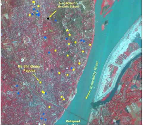
The Indian Space Research Organization (ISRO) has recently released the satellite image of the devastating 7.7 magnitude earthquake in Myanmar, which not only reflects the widespread damage caused by the earthquake, but also shows how this natural disaster destroys cities, historical sites and life completely. Everyone will be surprised to see these high-rugism photos, because it is not just the figures, but a living evidence of this terrible disaster.
ISRO’s images taken from Cartosat-3 satellite
Cartosat-3 satellite of ISRO has taken pictures of these earthquakes from a height of 500 km. The specialty of its picture is that this satellite can take high-employment images with less than 50 centimeters. It can be clearly seen in these images how the earthquake has injured the major cities and historical sites of Myanmar.

What was the loss?
ISRO reported in its report that the earthquake caused tremendous havoc in Myanmar’s second largest city Mandalay. The major heritage sites here, such as Sky Villas, Mahamuni Pagoda, and Ananda Pagoda have either suffered or partially damaged. Ananda Pagoda, which is a historic site recognized by UNESCO, has also become very bad.
The earthquake has also caused heavy damage to many monasteries and buildings in Sagaiing city of Myanmar. In addition, cracks have also appeared in the surrounding rivers in satellite paintings, indicating the soil being unstable during the earthquake. It is called liquidfaction, in which the land turns into mud with water and also damages buildings.
Causes of earthquake, collision of Indian and Eurasian plates
According to ISRO scientists, the Myanmar region is located on the border of Indian and Eurasian plates and earthquakes often occur here. The Indian plate moves about 5 cm north every year, causing seismic tension to accumulate. When this tension is suddenly released, big earthquakes occur, as seen in Myanmar.
Number of dead and difficulties of relief work
In this earthquake of Myanmar, 2,056 people have lost their lives and more than 3,900 people have been injured. About 270 people are still missing. After the earthquake, there are huge difficulties during relief work in Myanmar, as the ongoing civil war in the country has hindered helping.
Importance of ISRO satellite images
This satellite images of ISRO not only shows the damage caused by earthquakes in Myanmar, but also shows how natural disasters can be analyzed with the help of satellite -based technology. This can prove to be an important tool for disaster management, which will help run relief tasks in future quickly and effectively.
In this way the images sent by the satellite of ISRO have given a new vision to the world how we can get accurate information about natural disasters by using technology and quickly assess the situation after disaster.


